|

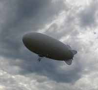
Designed by “Photogrammetria” Company unmanned aerial vehicle (UAV) is used as a platform for a digital camera.
On-board GPS receiver helps to follow and keep selected speed, course and height. The system of axes stabilization provides small tilt angles of the vehicle during air mapping. Sufficient carrying capacity makes it possible to use SRL cameras. Low speed, fine optics and high safety degree make it reasonable to apply this machine in following types of aerial mapping:
- large-scale (1:50, 1:100, 1:200) aerial mapping for landscaping;
- large-scale (1:50, 1:100) aerial mapping for architectural measurements of buildings roofs;
- aerial mapping of archaeological excavations;
- large-scale (1:200, 1:500, 1:1000) topography of built up areas.
more... |
|
|
|